
2.0 Direction Finding
There are essentially three basic methods which allow for the passive location of stationary ground-based emitters from airborne platforms.
Triangulation
Triangulation is likely the most commonly understood means of passively detecting emitter locations. This method relies on intersection of spatially displaced bearing measurements. The more accurate the measurement of the bearing is the more accurate the triangulation will tend to be. See the figure below.
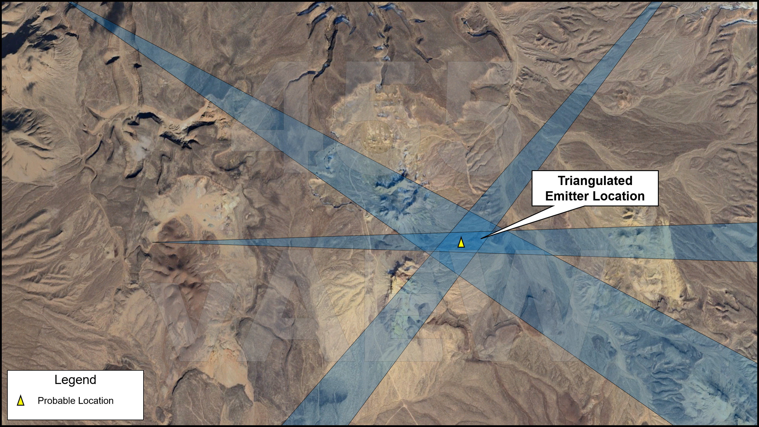
In this example we can clearly see that tighter bearings tend to generate more actionable location information. We can refine our triangulation further by reducing the angle of our bearings and increasing the number of measurements. While this example serves as a good conceptual overview of this technique it is important to understand there a variety of shortcomings as well as refinements which are often associated with this mode of location which are beyond the scope of this discussion.
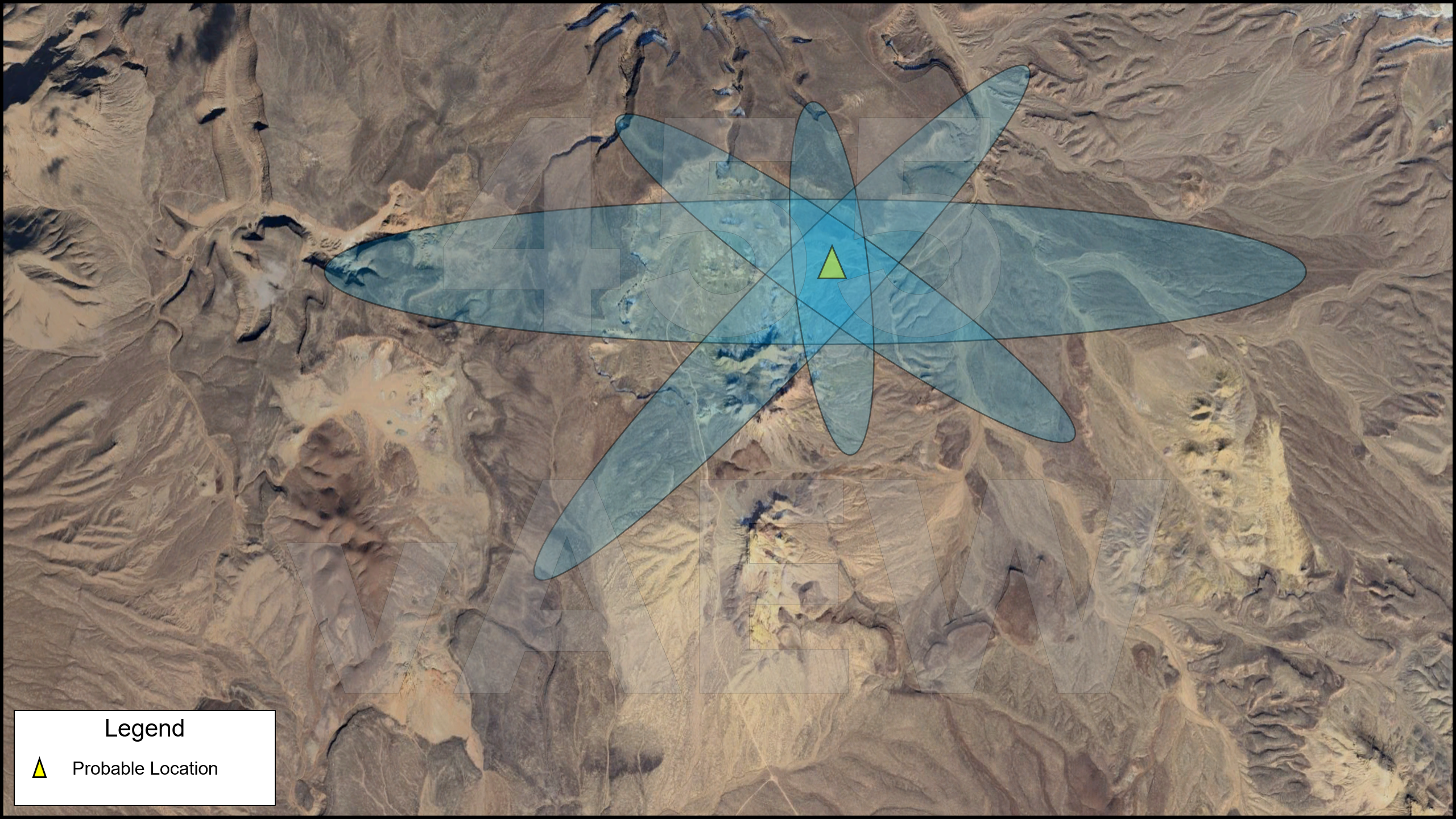
Azimuth Elevation
This technique enables the instantaneous emitter location from as single pulse using the intersection of measured azimuth and elevation lines. Typically, these measurements are depicted as a conical LOS angle λ. The projection of this conical shape on the grounds surfaces generates and ellipses pattern. The footprint of the ellipsoid is dependent on the angle of the conical shape as well as altitude of the detection platform. See the figure below.
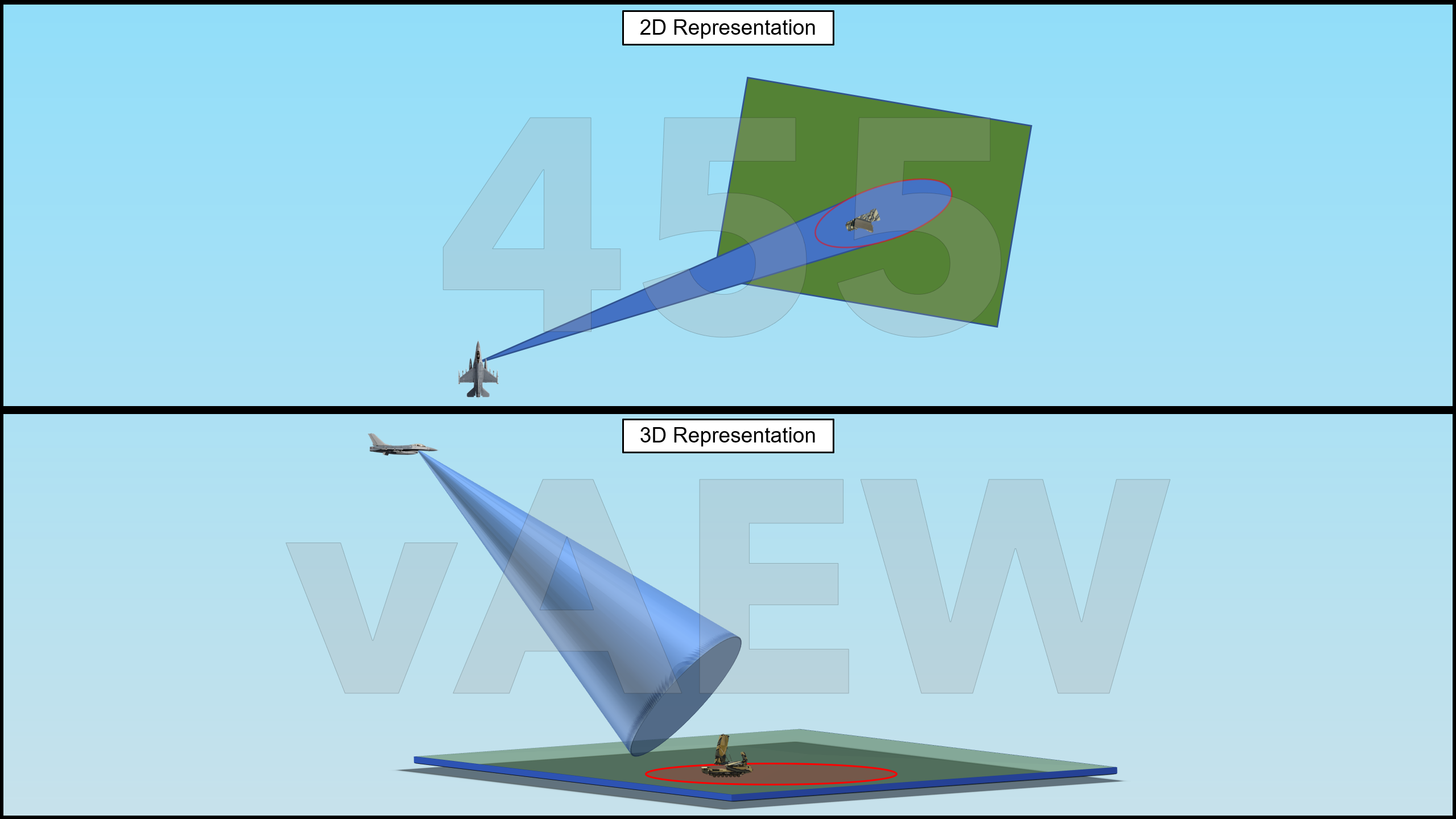
In this figure we can see how conical projection interacts with a flat ground surface. Consider the resultant ellipses in mountainous terrain. Also consider the angle of incidence and the resulting ellipse when the detection platform changes altitude. For example, higher altitudes will yield a smaller ellipse.
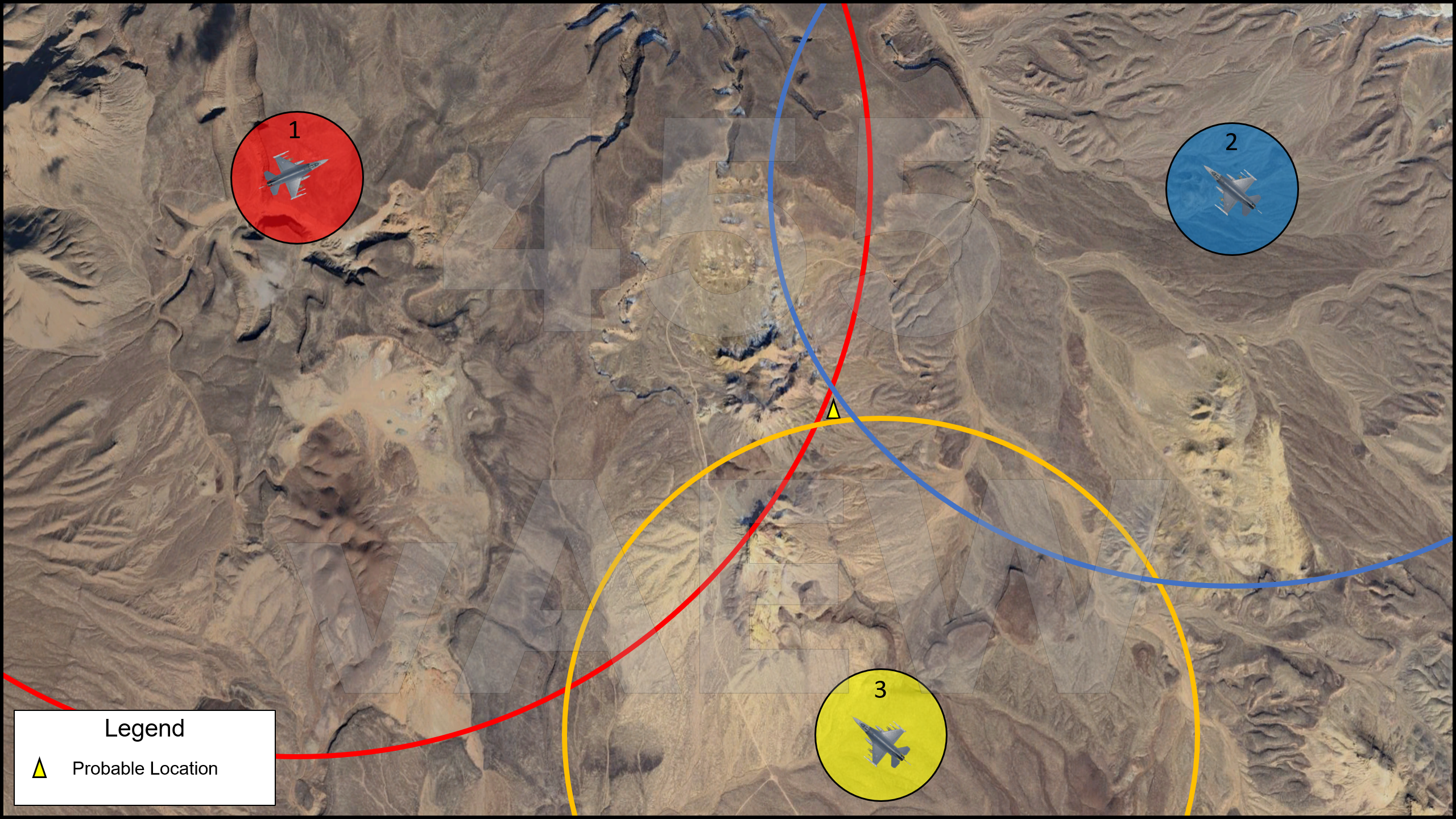
Time Difference of Arrival
This technique uses multiple distributed platforms to simultaneously collect an emission pulse and through comparative analysis measures the time difference of signal arrive. This technique relies on accurate date timestamping, data-linking and sharing, and signal processing. The distribution, dispositions, number of receiver platforms greatly effects the accuracy and resolution of this method. At least three collection points are necessary for a resolvable location. See the figure below.
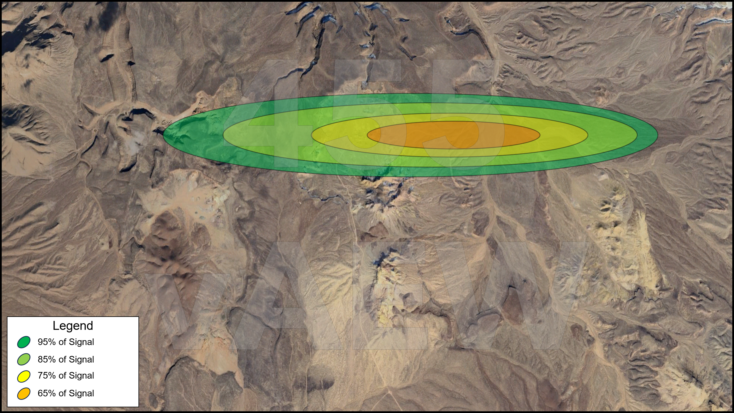
Blended Techniques
There are variety of techniques which build on these methods which could theoretically be used to refine the location emitter further such as statically analysis and data processing. These advanced techniques while interesting have little consequence on our discussion here. What is worth discussing is ellipse stacking. In this method, a collection platform offsets which generates varying AOAs and resulting ellipses. This enables triangulation through subsequent detections and yield range refinements.
It's possible the R7 version of the HTS may enable the data linked sharing of these ellipses. It’s also conceivable that the R7 version may use a variety of blended techniques.
No comments to display
No comments to display